In ancient times, there was only one drivable road leading from the east to the Asiago Plateau, which we all know very well (the Costo). However, the First World War required the opening of other routes on the mountain to connect Valsugana to the plateau. In this itinerary, that needs to be explored with calm and respect, we immerse ourselves in history and nature, not forgetting its hairpin turns and beautiful turns.
TOTAL DISTANCE: 133 km
HAIRPIN TURNS: ABOUT 50
DIFFICULTY: MODERATE
REGION: VENETO/TRENTINO ALTO ADIGE
STARTING POINT: VALSTAGNA (VI)
DESTINATION: ASIAGO (VI)
TIPS: IF POSSIBLE, AVOID WEEKENDS; BE AWARE OF CYCLISTS
RECOMMENDED STOP: LAGO DI LAVARONE (Lavarone Lake)
We set off from Valstagna, a small village in Valbrenta that offers beautiful views and areas waiting to be explored by hiking enthusiasts. Near the Rialto Bridge of Valstagna, we take Via IV Novembre, where the first protagonist of this itinerary awaits us: the SP73 Campesana – Valvecchia.
The story behind this place is interesting, and I want to briefly tell you about it. Towards the end of the 1300s, Foza and Gallio were in conflict over tolls imposed on goods traffic heading north. Due to these disputes, Gian Galeazzo Visconti, the Lord of Milan, had the famous Calà del Sasso built—an engineering masterpiece unique for its time and still popular today for being the longest natural stone staircase in the world, with its 4444 steps. However, of course, it was not originally a drivable road. It only became an access route during the First World War (1916) when a road was built in the same area using all available resources, including local women who transported sand and timber. In 1970, it was fully asphalted for the first time, becoming accessible to all vehicles.

Upon reaching Foza, you can continue to the right towards Enego and venture towards the Marcesina plain. As of the time of writing (June 2023), the road to Marcesina is in a very poor state and closed to traffic, so it’s best to check if it has been reopened before planning to go there.
We turn left towards Asiago, passing through the beautiful town that symbolizes the Altopiano dei Sette Comuni (Plateau of the Seven Municipalities) and taking the SP349 Passo Vezzena road. Here, the Vaia disaster left deep scars and completely changed the landscape, but the mountain atmosphere of peace and tranquility still prevails. Amongst Alpine huts and pastures, you can also admire the characteristic church of S. Zita on the right.
This stretch is highly traveled by motorcyclists who often stop at the Hotel Vezzena parking lot.
Continuing towards Lavarone, we can take a well-deserved break at the lake of the same name. We are now in the area known as Alpe Cimbra, a unique territory that includes Lavarone, Folgaria, and Luserna.
We proceed towards Carbonare and, at the junction, we take the SP142 to the left. This road is truly something that will remain in your heart. Vast meadows and pastures with small groves surrounded by mountains, during the early days of summer, you can admire vast fields of wildflowers.
We pass by Villaggio Fiorentini, Passo della Vena, and continue on the SP64, which will take us through the villages of Tonezza di Cimone and Arsiero. Arriving at Cogollo del Cengio, we take the winding Via Olmo that leads to the famous Strada Provinciale 349 del Costo.
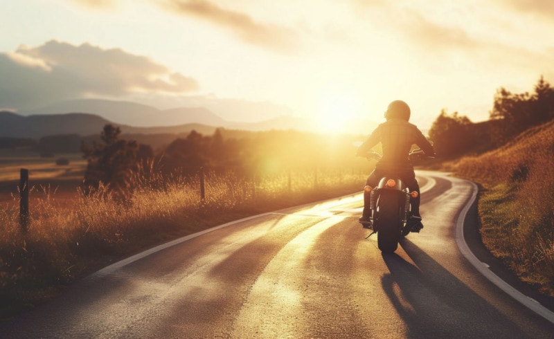
As for how we love to experience motorcycling, it is better to travel this road with its wide and well-paved hairpin turns during the week and avoid the busy weekends. Still, use utmost caution and ride calmly and responsibly.
This was the second drivable road providing access to the Altopiano dei Sette Comuni from the east. The road dates back to 1852 and roughly follows the ancient Costo road (dating back to the Roman era), which was used for centuries as a connecting route between the Vicenza plains and the Plateau and is now accessible for walking once again.
After a few kilometers, we reach the final stage of our itinerary: Asiago. I advise you to experience this journey slowly, with the true slow ride spirit, respecting the mountains, the small villages, and their people.
Note: Another ancient road called “Piovega di Sopra” allows access from the northeast to Enego; it can also be accessed from Valbrenta, near Primolano, on the right bank of the Brenta River. In the valley, you will find the hamlet of Pianello. As you ascend the provincial road, you will encounter the first clusters of houses: La Bastìa and the hamlet of Fosse, divided into Fosse di Sotto, Fosse di Mezzo, and Fosse di Sopra. After the last stretch, we arrive at Piazze di Enego at 750 meters above sea level, where the main road continues towards Foza – Gallio – Asiago.